
Lèvtèt
Details
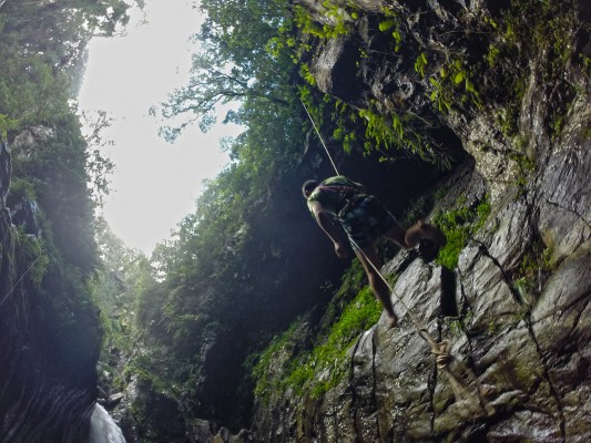
- Type : Waterline.
- Nickname : Lèvtèt.
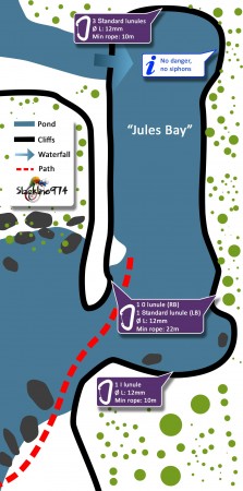
- Place : Reunion Island, Saint Joseph, Langevin river, Jules Bay.
- Length : 22m
- Hight : 1.5m
- GPS (line): -21.35356, 55.6478
- Upstream side access : EASY
- Downstream side access : EASY
- No hiking.
- IGN Map at 25000th 4406RT La Fournaise.
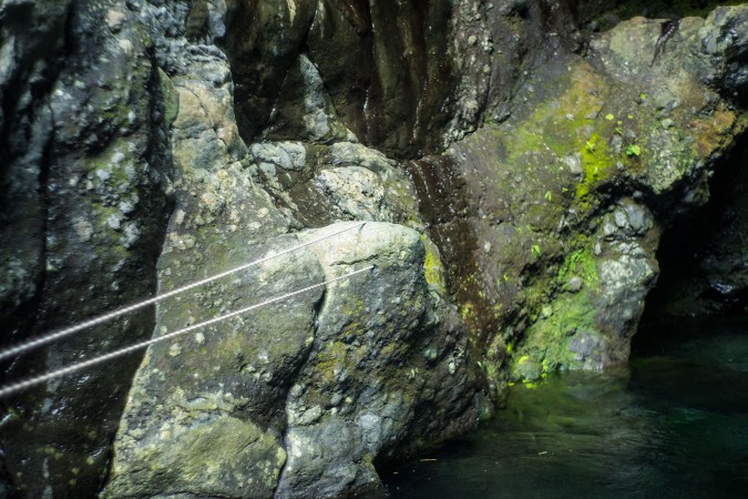
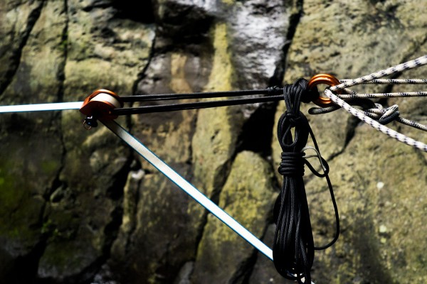
- 6 “standard” lunules Ø12mm (line, backup).
- 1 “0” lunule Ø12mm (line).
- 1 “I” lunule Ø12mm (backup).
- Period: Summer, from December to May, or after floods.
Presentation
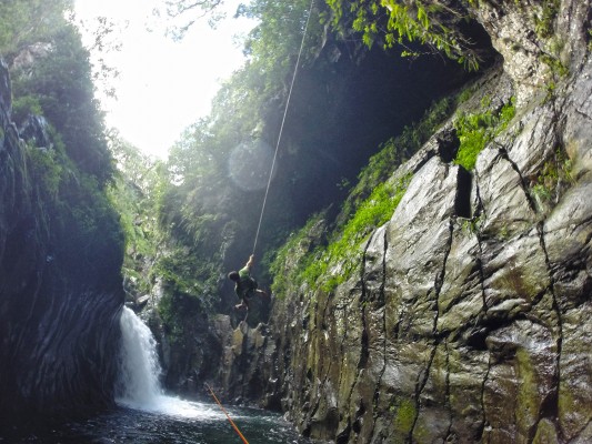
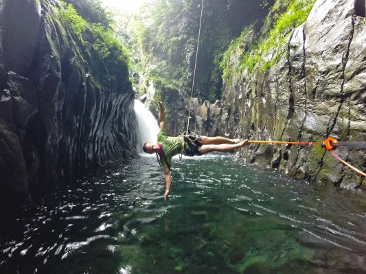
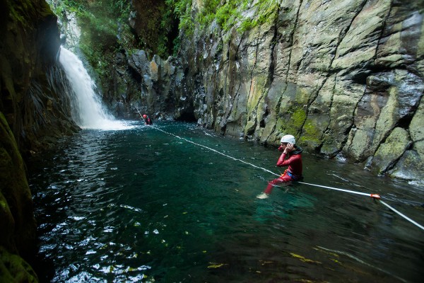
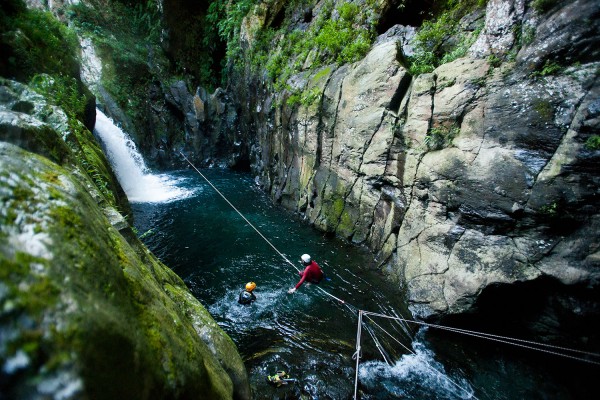
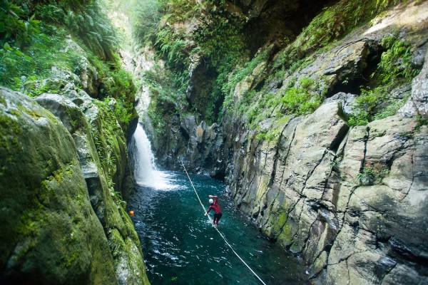
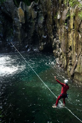
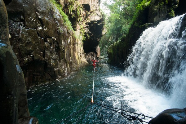
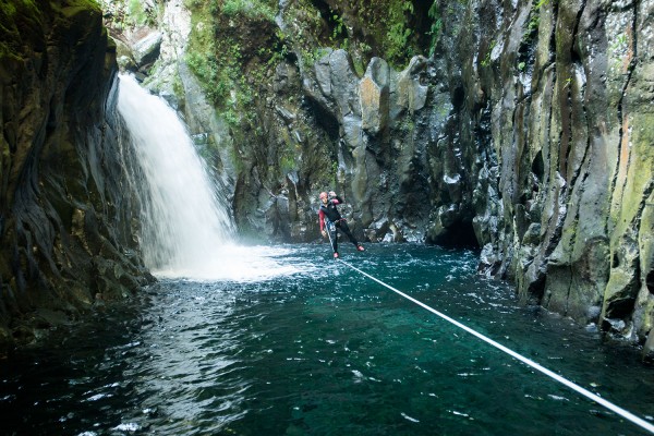
Probably the most beautiful waterline of the island! In addition to this, it is easier to access, unthinkable!
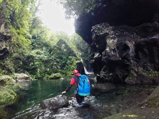
Always in the Langevin river, this pond exist (or is viable) only during heavy rains, thus more accessible in summer.
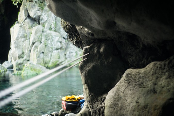
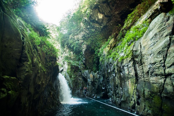
The site is just beautiful, like something out of a novel, or of the heart of the Amazon forest …
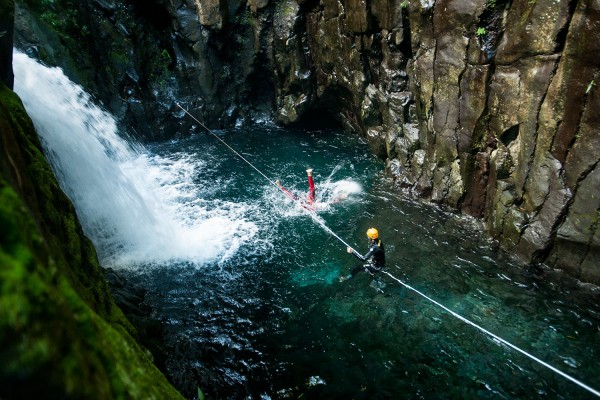
Waterfall, translucent turquoise water, flourishing vegetation, huge arch overlooking the site, no siphon, perfect rock, no pollution … In short, everything to like.
Defects?
A very small window for the sun (11:00 a.m. – 02:00 p.m. in summer, 00:30 p.m. – 01:30 p.m. in winter) and the OBLIGATION to wear a helmet (cliff above).
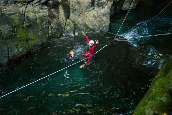
Lèvtèt is the first drink of the day (which makes up the head). It sticks well to the line, always looking up to admire the place!
Site access
- From the North : Take the RN4 to Saint-Pierre, then take the exit for Saint Joseph.
Once on the RN2, continue to Saint Joseph, pass the bridge of the “Rivière des Remparts” and drive over 3.5km.
Cross the bridge of the “Rivière Langevin”, then take the first left, just after the “balance canne à sucre” on the “Rue de La Passerelle”.
- From the south : From the RN2, pass Vincendo and head towards Saint Jospeh. Just before the bridge of the “Rivière Langevin”, turn right and go on the “Rue de La Passerelle”, just before the “balance canne à sucre”.
Follow the road for 3.5 km, cross the first bridge and park just after the small parking alongside a shrine.
Go back up the river for 50m, cross the river, and just swim to install the line!
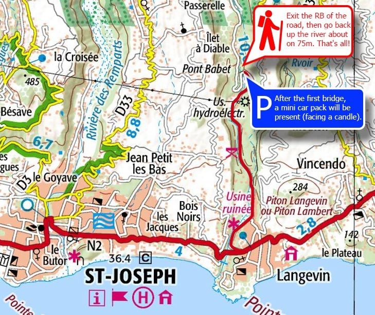
Anchors access
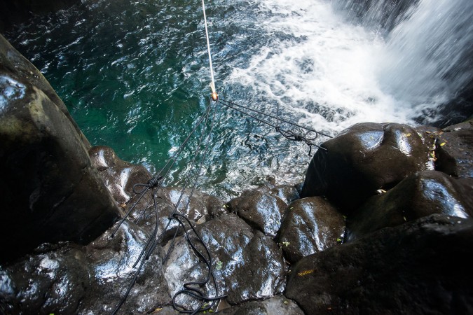
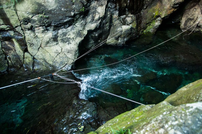
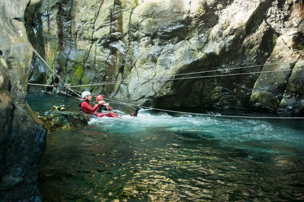
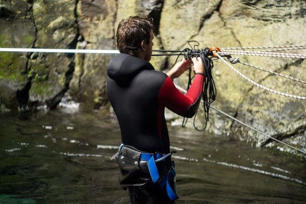
Tension ans equalization
- Tension downstream side with double pulleys, lashing or equivalent.
- Equalization with, 8m (tension) and 4m (backup) of rope upstream side, as well as with 22m (tension) and 10m (backup) of rope downstream.
Remarks
- Warning: spot considered identical as a canyon, thus the same canyoning safety rules must be applied.
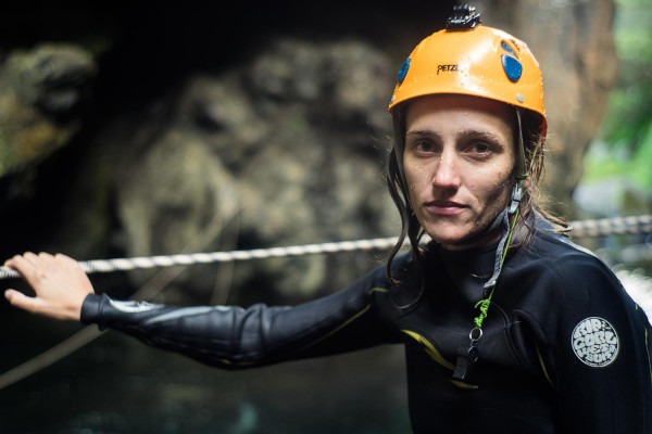
- Helmet required!
- Backup your line!
- Dyneema rope recommanded for downstream side.
- Very small window for the sun.
- Take care of the place, do not let your waste!
Credits
- Lunules (August 2016), texts, sketchs, pictures: BK (https://www.facebook.com/kevin.borg.9).
Pictures (Tanks to Élodie and Arthur)
Commentaires


